Kinmen is a Taiwanese island just a few kilometres off the coast of mainland China. It’s a place on the borderlines which lies in between two different places somehow belonging to both and neither at the same time.
Of course, politically, Kinmen is part of Taiwan, and the various museums and monuments never fail to highlight (sometimes in gory detail) how R.O.C. forces defeated the Communists here during the Chinese civil war in 1949.
If we can trust my fitness tracker, I’ve taken about 51 thousand steps (or well more than a marathon) during my first two days exploring Kinmen and its sister island Lieyu (and this doesn’t include another 20 km cycling around Lieyu). That said, I can’t leave without a hike. The highest point on the island is Taiwushan, and I save hiking it for the third and last day of my visit.
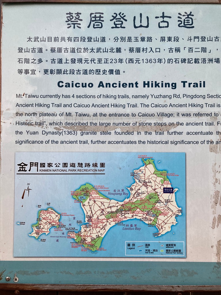
Not having a car or a scooter is limiting my options. I make sure I take the first bus from Xiguoshan to Shanwai and grab a taxi from there. I arrive at the 蔡厝古道 Caicou Ancient Hiking Trail trailhead a few minutes before 7 am and start ascending in the early morning dawn. After climbing a few flights of stairs and a short stretch through a forest, the trail reaches a beautiful set of boulders leading up to the ridge. The morning light illuminates them beautifully, next time I shall try to come for sunrise.
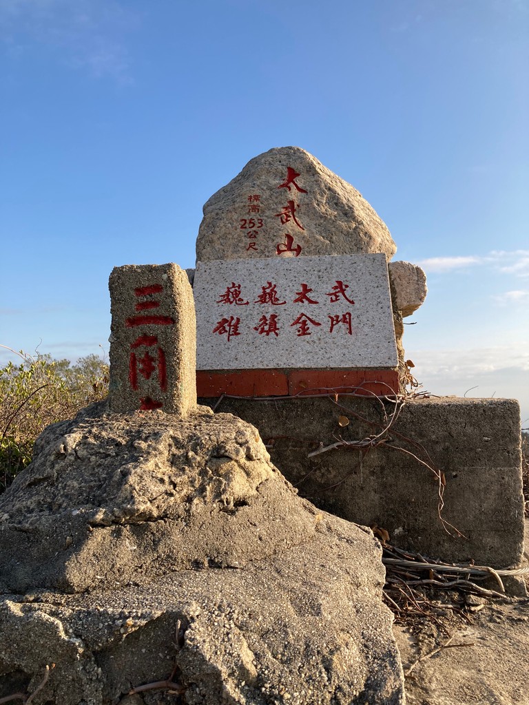
At this part, the main trail continues towards 玉章路 Yuzhang Road. My gut feeling tells me that this won’t bring me to the summit. I try anyway, but sure enough, all trails leading up from the main road are dead ends or closed for military purposes. Instead, if you want to avoid my small detour watch out for a prominent boulder called Yuan Stele (there’s a signboard) and follow the dirt trail which branches off from there, this will lead you to an old military watchtower overlooking the island as well as the peak. As a side note, I’m not convinced that the location of Taiwushan on most online maps is accurate. Based on my summit marker (253 m) photo, I’d put it at 24°27'55.0"N 118°25'03.4"E.
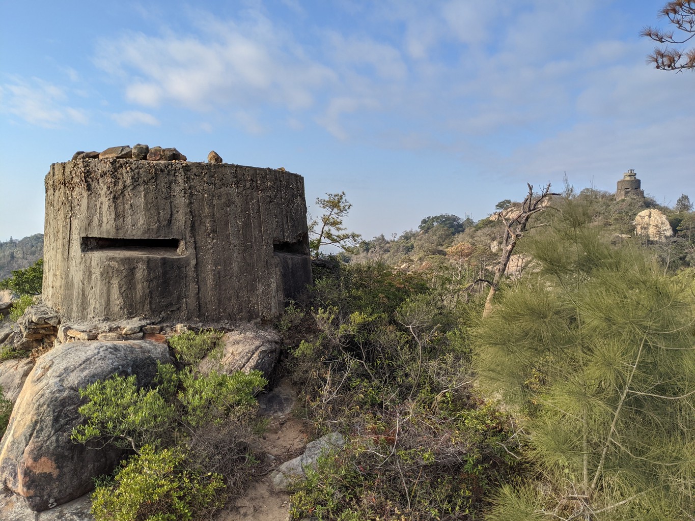
There are many side trails (ironically, easy to find by the accomodating warning signs), and they almost always lead to another bunker or military relic. These small trails while unmarked are in good condition and seem frequently used. They’re easy to follow and as far as I understand it’s not forbidden to use them. That said, always check the latest rules and never wander off the trails!
The top of the ridge with its large boulders is the most beautiful part of this hike. I discover a few more abandoned military watchposts on my way down before the trail meets the road (玉章路) again. I pass the entrance to some military complex and continue down to 屏東 Pingtun. Back in Shanwai, I finish my short but delightful morning hike with delicious Cantonese congee and 豆浆 (soymilk, my Chinese word for the day) at .