
In 1971, a group of Taiwanese hikers compiled a list that’s since become known as the 台灣百嶽 Taiwan Baiyue. It’s a collection of one hundred peaks in Taiwan above 3000 m (technically, there are two exceptions with Liushunshan and Lushan having since been resurveyed to be “only” 2999 and 2981 meters high, respectively). As such it’s a bucket list of sorts for any avid hiker in Taiwan. It’s a daunting task because many of the peaks are remote and require multi-day treks, experience, equipment and often permits.
I create a bucket list in my notebook but soon get bored with the tedious task of copying the peaks’ names by hand. Let’s hope I’ll have more patience climbing (some of) them.
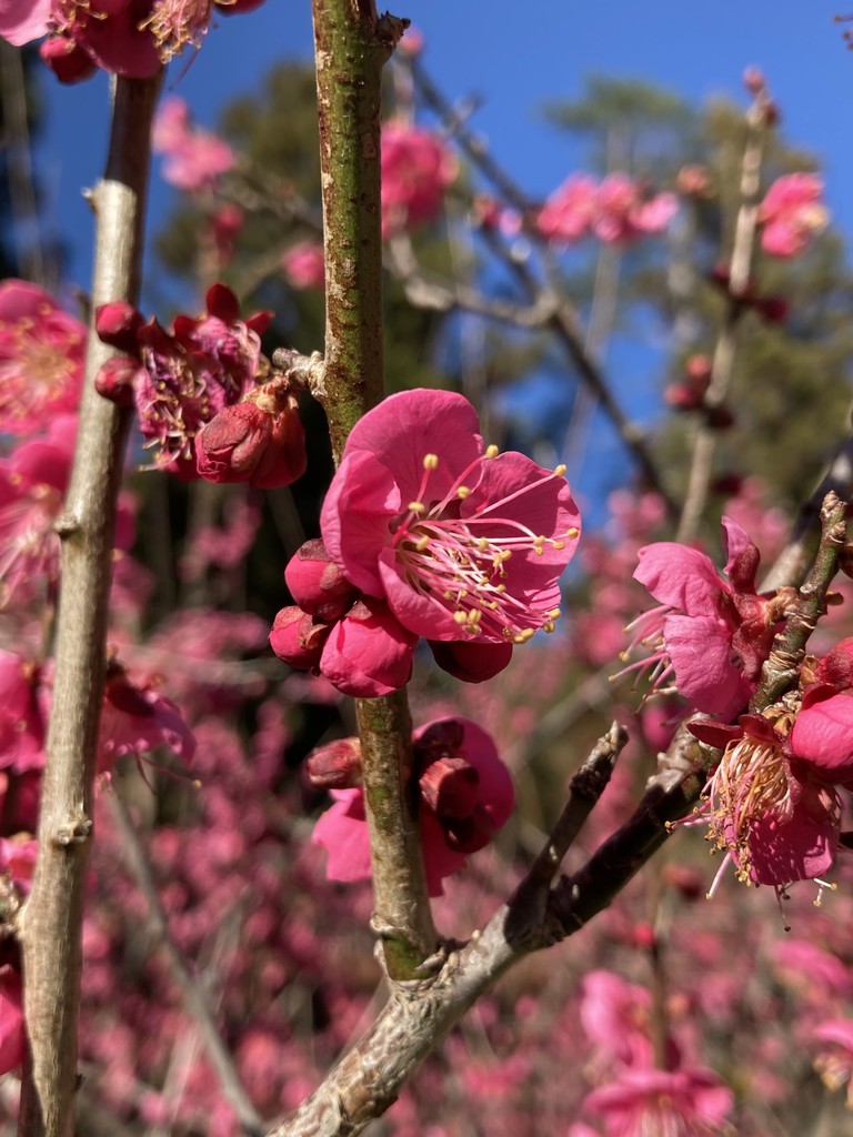
I decide to join a tour to climb 雪山 Xueshan via an alternative route through the 黑森林 Black Forest and across the 聖稜線縱走 Holy Ridge from the North. Even the names are impressive: the term “Black Forest” stems from the fact that it’s so dense you can barely see the sky. There are also stories of hikers getting lost in it.
Japanese climber and founder of the Taiwan Mountain Society, Numai Tetsutarō first described the Holy Ridge trail in 1927. The saying goes that you’re only qualified to get married once you finish it. The idea being the prospective spouse needs to overcome the challenges along the trail to prove they can shoulder the responsibilities of growing a family. It’s a good story, but maybe it’s also the case that you can only do it before getting married because your partner wouldn’t want you to go on a lengthy and dangerous adventure once you have a family.
這神聖的稜線啊! this sacred ridge
誰能真正完成大霸尖山至雪山的縱走,who can complete the vertical walk from Dabajian to Snow Mountain
戴上勝利的榮冠, put on the crown of victory,
敘說首次完成縱走的真與美? narrate the truth and beauty of the first vertical walk?– Numai Tetsutarō
The Holy Ridge is now an established trail with multiple variants and extensions. There are some fixed ropes too, and it’s considerably easier to conquer than when a team of mountaineers first traversed it in 1931. Our tour guide tells us it takes seven days to complete, but you can do it in 5 “if you’re mad”. I later find a blog post where he did it in 4. I’ll have to ask him about this next time.
However, we shall only traverse a short section of the ridge on this trip, but I’m already getting ahead of myself.
We meet at Wanlong at 5 am on a Wednesday morning. The drive to Wuling Farm takes around 4 hours, and after preparing some sandwiches and checking our equipment, we hit the trail around 10 am.
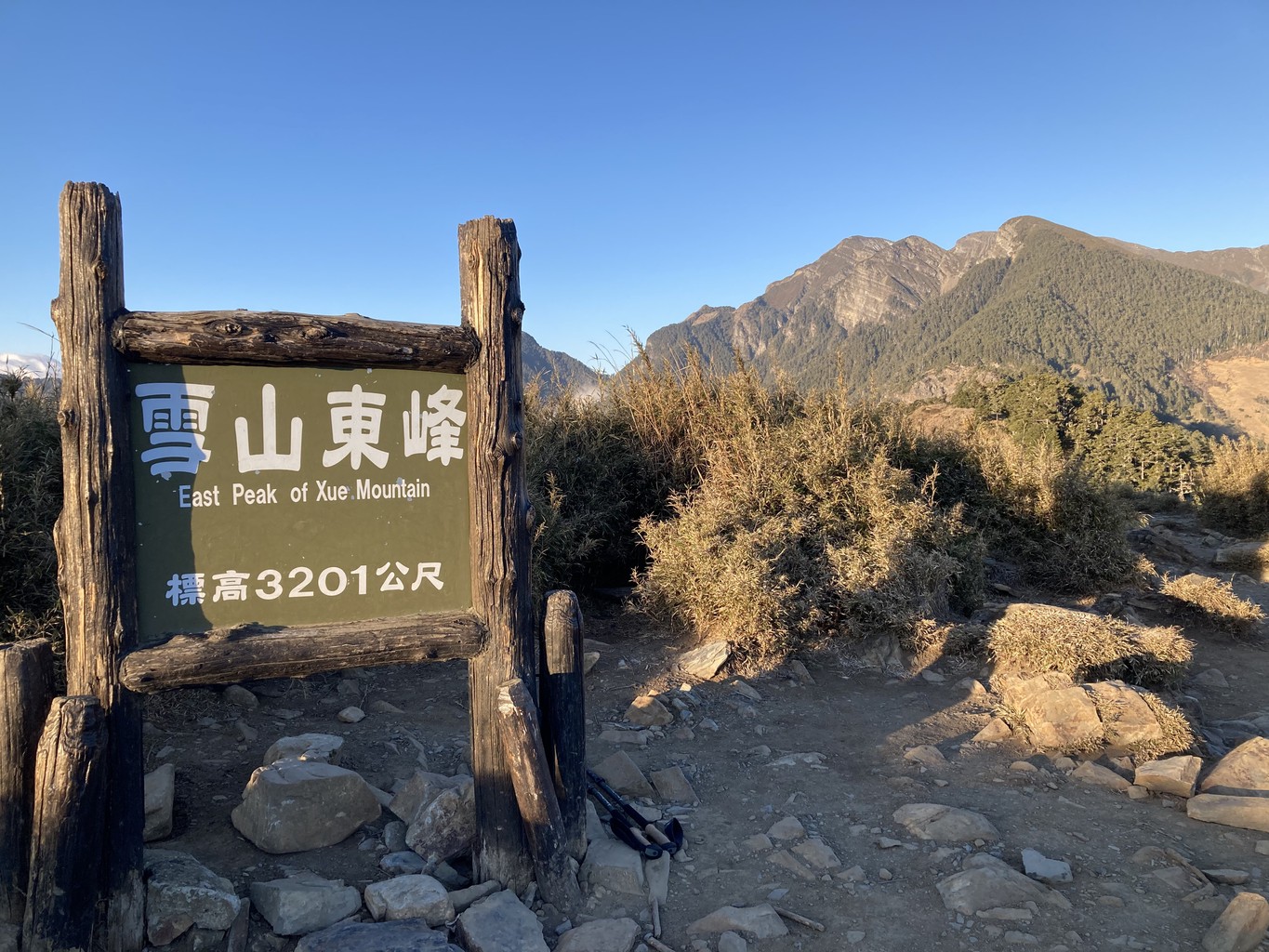
We start at a steady pace and soon reach 七卡山莊 Qika cabin for a first break. From here, we continue further up through the forest until we arrive at a viewing platform just before 哭坡 the “slope of pain” towards Xueshan East Peak. I’m feeling strong and decide to get the “pain” over with fast, rushing up in just under 10 minutes. It’s a fun little push but likely also the reason I’ll have trouble acclimatising and sleeping later that night.
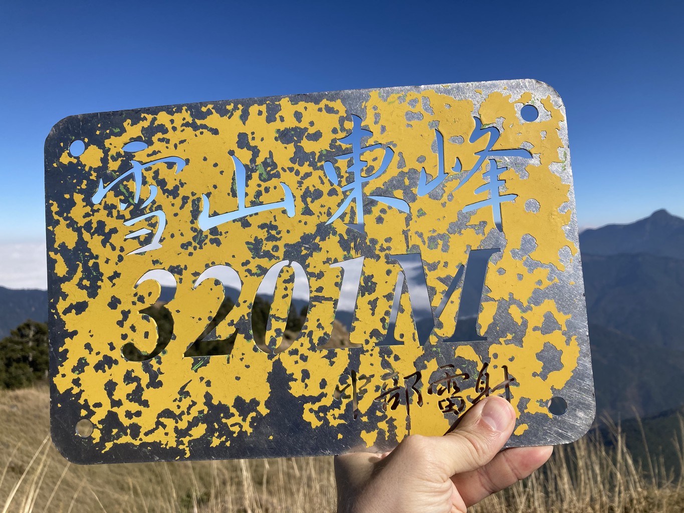
Soon thereafter, our group reaches the top of 雪山東峰 Xueshan East Peak at 3201 m in perfect sunshine. We take some photos and slowly descend to 三六九山莊 369 cabin our home for the next two nights. The cabin (I once refer to it as a “guesthouse” much to the amusement of our guides) is a simple structure sheltering climbers from the elements. It does that well but not much more. There’s no running water, no electricity and no heating. The only thing to do after dark is getting warm, snuggle inside your sleeping bag and try to get some rest.
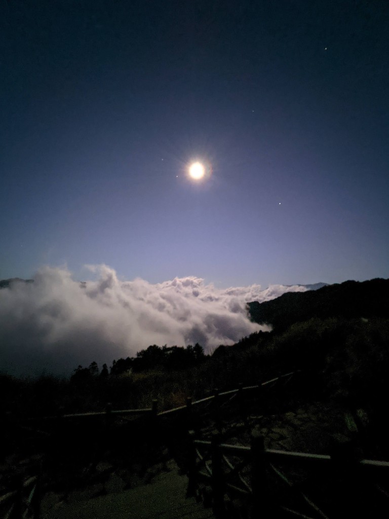
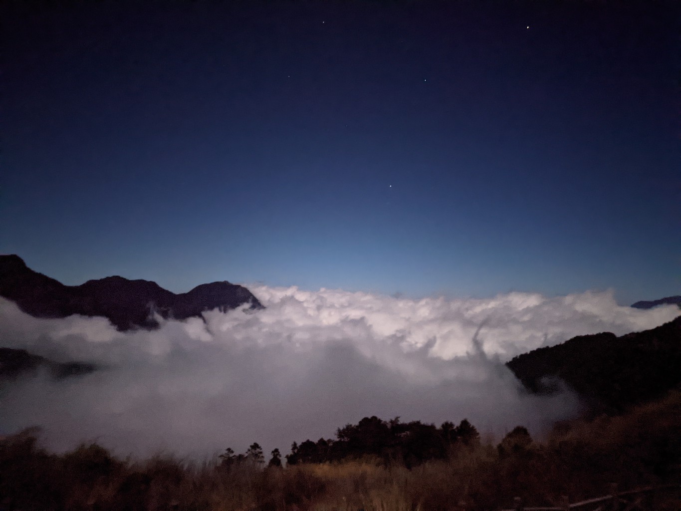
We watch a fantastic sunset under a full moon before heading inside. I have a hard time getting warm, and after I get warm, I have a hard time falling asleep. I get up multiple times, having a runny nose and a mild headache and feeling convinced that I won’t be able to hike tomorrow. I finally do some breathing exercises outside the cabin around 1 am, which helps because soon after I eventually fall into a short but profound sleep.
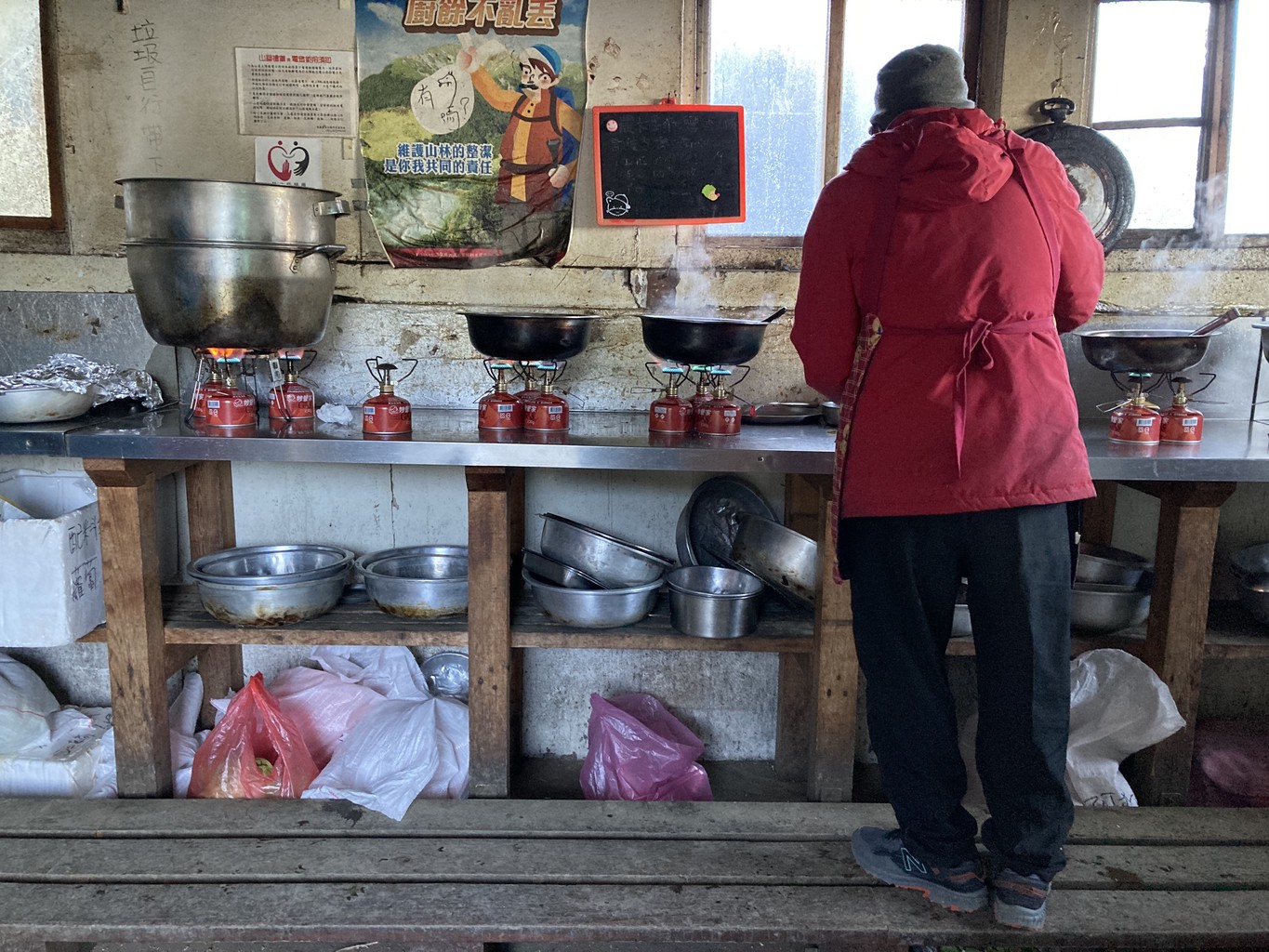
Our wake-up call is at 2 am and all in all, I’ve had about 2 hours of sleep. The last hour has done magic, though as I feel strong and ready. The person running the cabin is a Taiwanese man in his sixties joking around and telling his stories to everyone who’d listen. It’s impressive what delicious meals he can prepare up here with just a handful of gas cookers and basic ingredients: unbelievably yummy breakfast muffins and hot coffee from a French press. I feel like the happiest person on earth.
We put on headlamps and start ascending on an old trail through the Black Forest. Far fewer hikers use it than the normal route, and previous landslides have obscured it at parts. We have to climb over or under a few trees but aside from a short icy section which we manoeuvre carefully, it’s a technically straightforward hike. Once we’re above the tree line, we hit a scree field and with it the icy winds that have come up overnight. It’s a more challenging climb from here, but it’s also precisely my kind of thing.
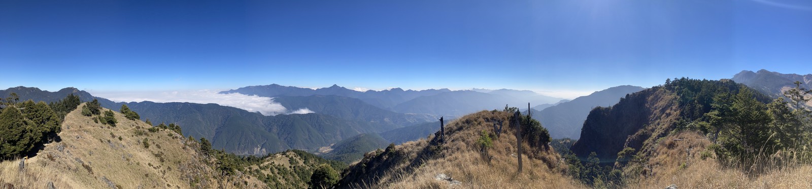
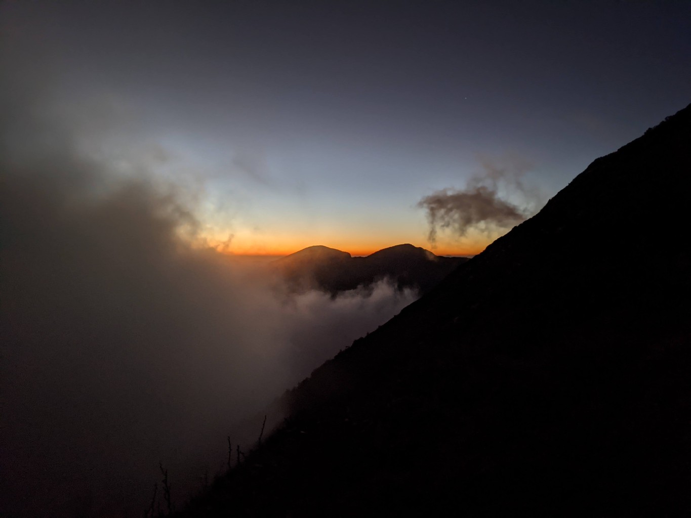
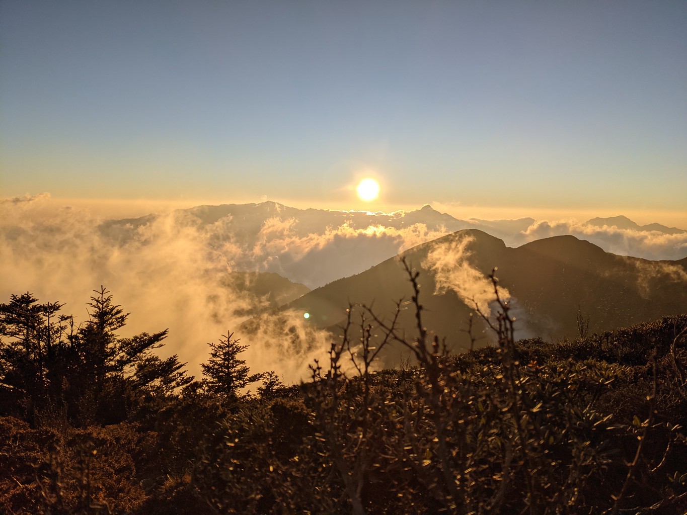
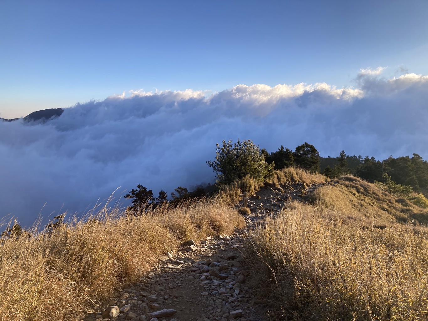
I’m the first in our group to reach the ridge and take a short video before finding shelter from the wind. The views of the rising sun and the wind pressing the clouds against the side of the mountain are breathtakenly beautiful. Capturing them is a bit of a challenge, though, with temperatures around freezing and the significant wind chill making every second without gloves an uncomfortable endeavour.
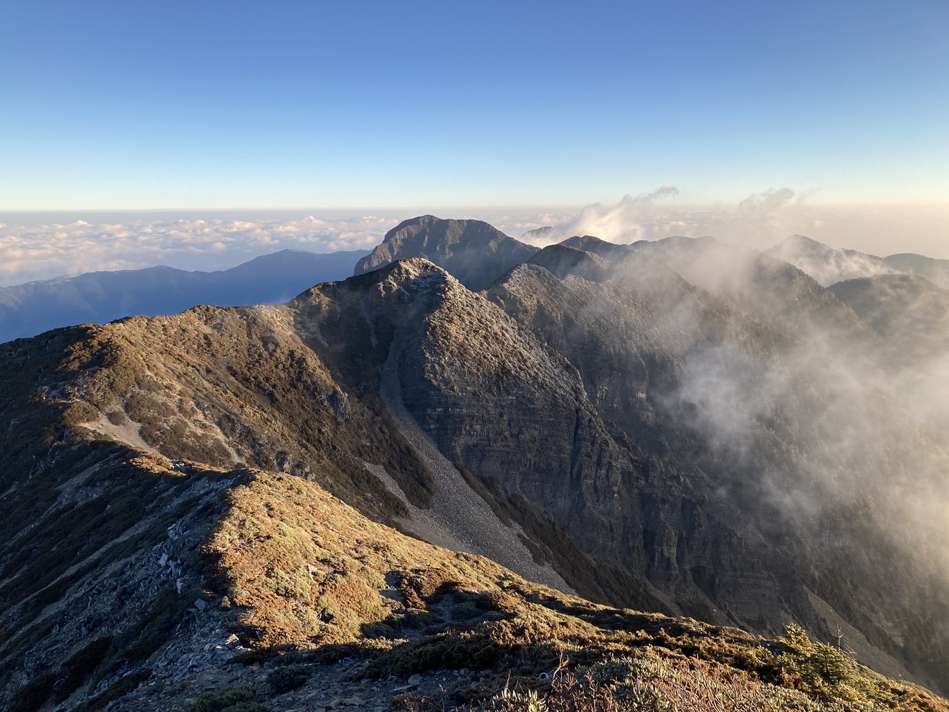
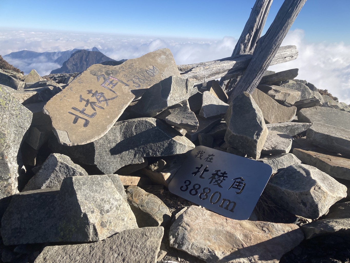
After a short break, we continue along the ridge until we find a good spot out of the wind to have breakfast and enjoy the magnificent morning views. We then continue to 北稜角 Bei Ling Jiao and contemplate whether to make the detour to 翠池 Cuichi Pond or go straight to the main peak. It’s still early in the day, so we decide to take the 2.5-hour detour. Due to little precipitation, the Cuichi “Lake” turns out to be nothing more than a small patch of frozen water. It’s still an enjoyable hike down from and back up to ridge through this vast, untouched mountain range. We’re lucky to have this marvel of nature almost all to ourselves on this day.
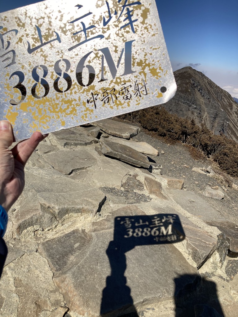
After returning from Cuichi Pond, we reach the summit in a final quick push. It’s windy but beautiful, and we enjoy our time on the top. On the way down, I begin to feel the struggles of a long day (and a short night), and it becomes an uncomfortably long 2-hour walk back to the cabin. I finish my last sips of water, find some electrolyte snacks and a piece of chocolate to give me energy for the final kilometres. Once the trail becomes easy, I pick up the pace to reach 369 cabin. It’s been glorious and beautiful, but I’ve also had enough hiking for the day. I arrive at the cabin, quickly get changed and into my sleeping bag to take a nap. I wake up for dinner and fall asleep again soon after. Unlike the previous night, I sleep like a baby.
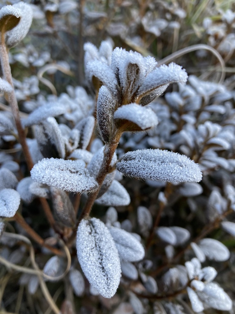
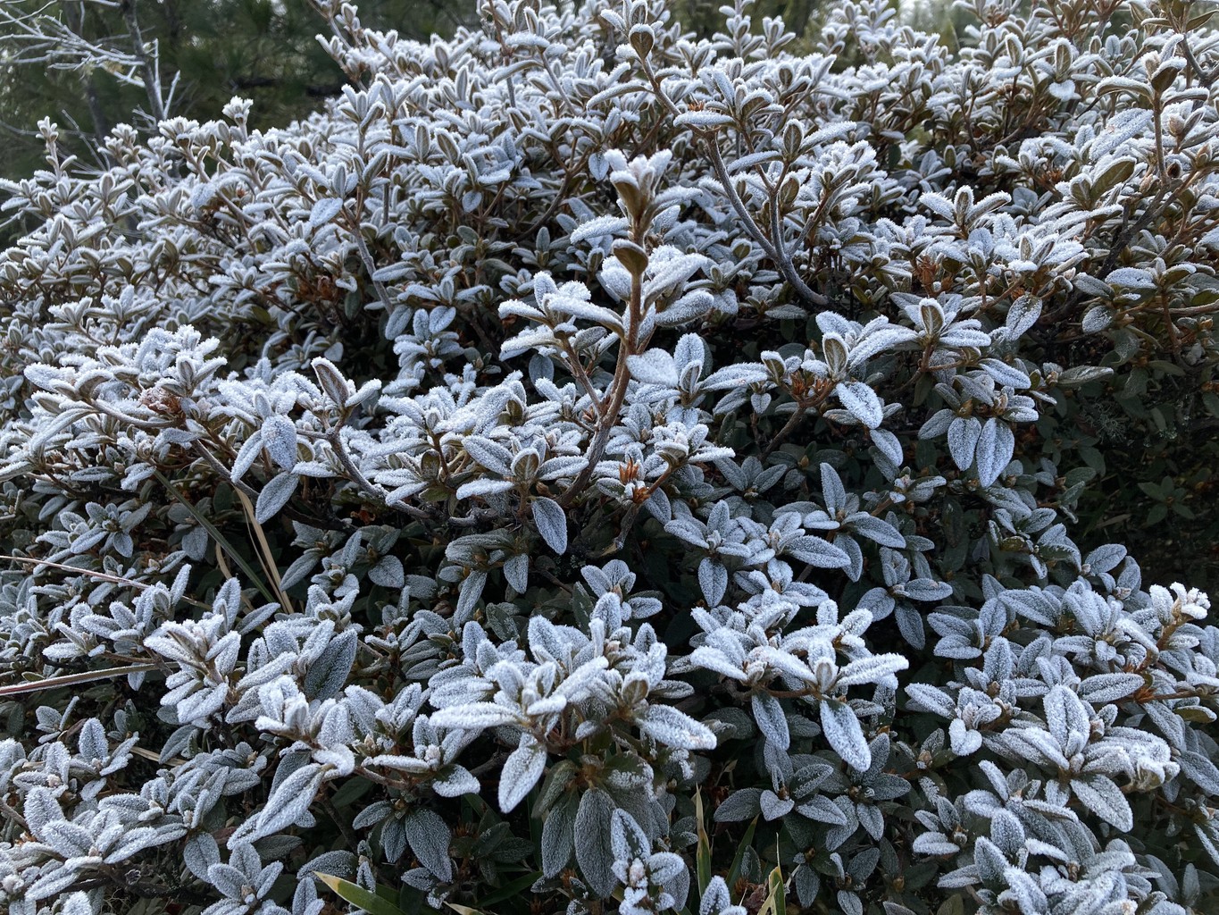
On our third and final day, we start around 5 am, and I take a quick detour to visit Xueshan East Peak for a second time. I arrive shortly after sunrise and spend a peaceful and beautiful couple of moments on the top by myself. After that it’s a slow and steady descend, first to Qika cabin and then back to the trailhead, all the way marvelling at the beauty of the frozen morning dew covering the forest in an icy beauty.