I meet our guide, Manu, at 5:30 a.m. in front of Taipei Main Station. Our driver soon sets off with the other six group members, a black minivan cruising through the cloudy Saturday morning dawn. One and a half hours later, we stop at a convenience store. I get my first and only chance to grab some coffee. After a long break from hiking, 4 a.m. wake-up calls don’t come naturally anymore.
The road gets narrow as it begins to wind up into the mountains. We pass increasingly remote villages, the names of indigenous tribes written on signboards at the side of the road, ornamented in red, white and black. Thousands of stories and traditions lie behind the doors of each village. We’ve come to hike in their mountains, but understanding their culture and lifestyle is more complicated.
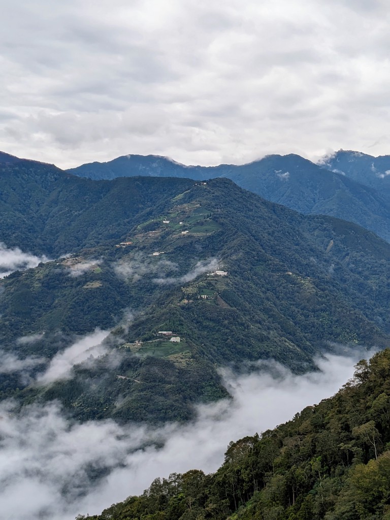
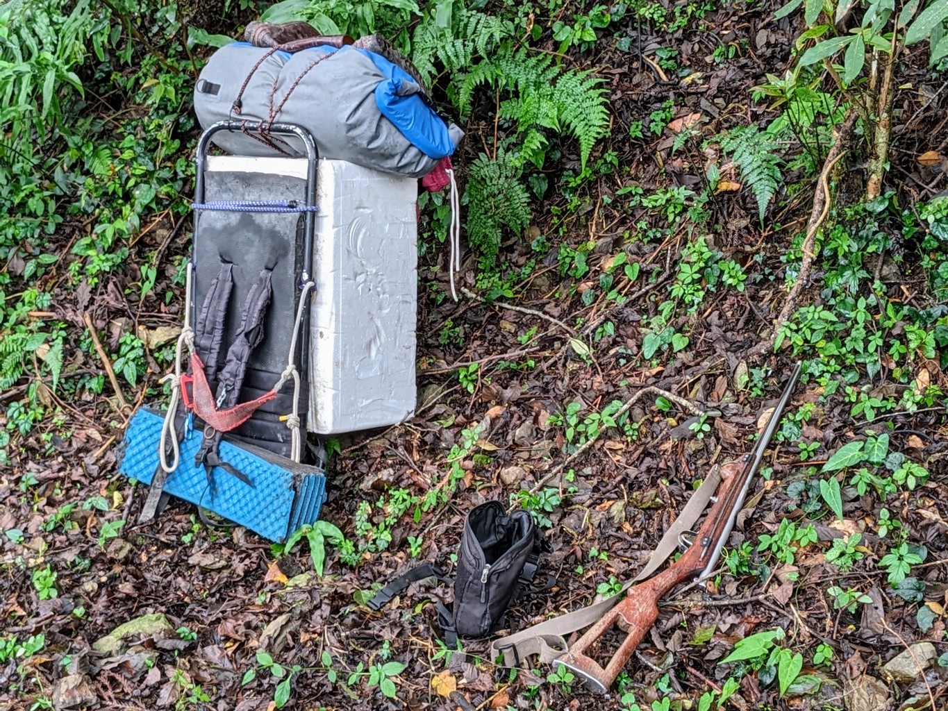
Around 8 a.m., our bus comes to a stop. An excavation vehicle blocks the road, its driver nowhere to be seen. We speak to a group of local hunters about to set off into the forest on their dirt road motorcycles, guns swung around their shoulders. We learn the road is being repaired after a recent landslide, and there’s no way to continue by car. We’re four kilometres from the trailhead, and the decision is made to start walking from here, not that there’s much of a choice. We’re treated with clearer views of the surrounding hills than from the van, little settlements peaking out here and there from the green of the trees. An hour later, we reach the Shihlu Trailhead of the Syakaro (霞喀羅 Xiakelo in Chinese) Trail in 五峰 Wufeng, a remote area deep in the Southeast of 新竹 Hsinchu County.
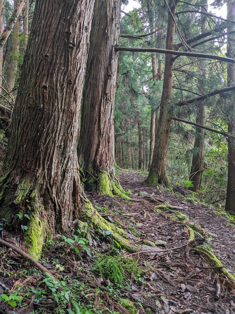
Syakaro is the Atayal word for Formosan Michelia 烏心石, a magnolia tree common in the area. The trail has been used by indigenous people for many generations to travel between tribes. During their occupation of Taiwan, the Japanese widened it for the use of vehicles in the 1920s. They erected multiple police outposts to control and suppress the indigenous population.
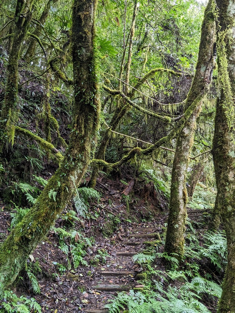
The trail was almost 50 kilometres long; most are modern roads today. The remaining 22 kilometres form the Syakaro Historic Trail, designated Taiwan’s first National Trail in 2003. Cutting through dense forest, it sits between 1200 and 2000 meters and boasts some of Taiwan’s richest biodiversity. We’ve come in autumn hoping to see the colourful leaves of the maple trees.
Around 9 a.m., we embark on the trail and soon reach the first steeper sections. We cover most of the climb to the highest point at around 2000 meters in the first hour and a half. “It’s only getting easier from here”. Guide Manu tries to keep everyone’s spirits high. Dressed in shorts, running shoes and an orange cotton shirt, he looks merely going for a stroll, navigating the trail with enviable ease and setting a nice, solid pace. I can’t remember seeing him break a sweat once on the entire 26-kilometre journey, even when he jogged back and forth between the front and back of our group to keep all of us together.
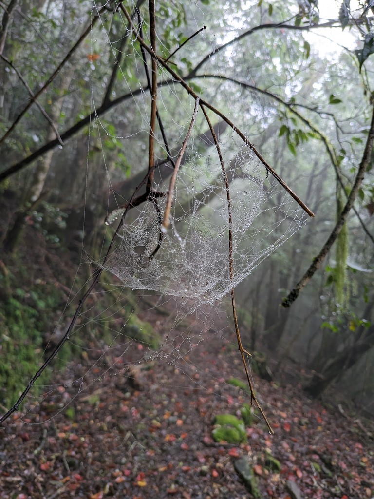
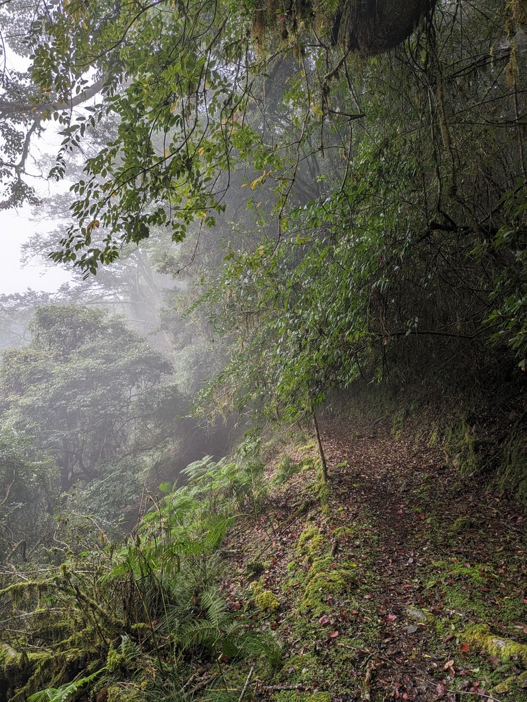
The trail gets easier as we pass through a foggy section. The sunlight breaks through it, creating a magical atmosphere reminiscent of what I’ve encountered on many previous hikes in Taiwan, like Rome Ridge or Songluo. It speaks to the beauty of Taiwan’s trails that it doesn’t require a cloudless day. Heck, it doesn’t need any views, a “complaint” another group member will make later when I ask her how she liked it. A foggy day in the forest is still one of the most beautiful and unique sights.
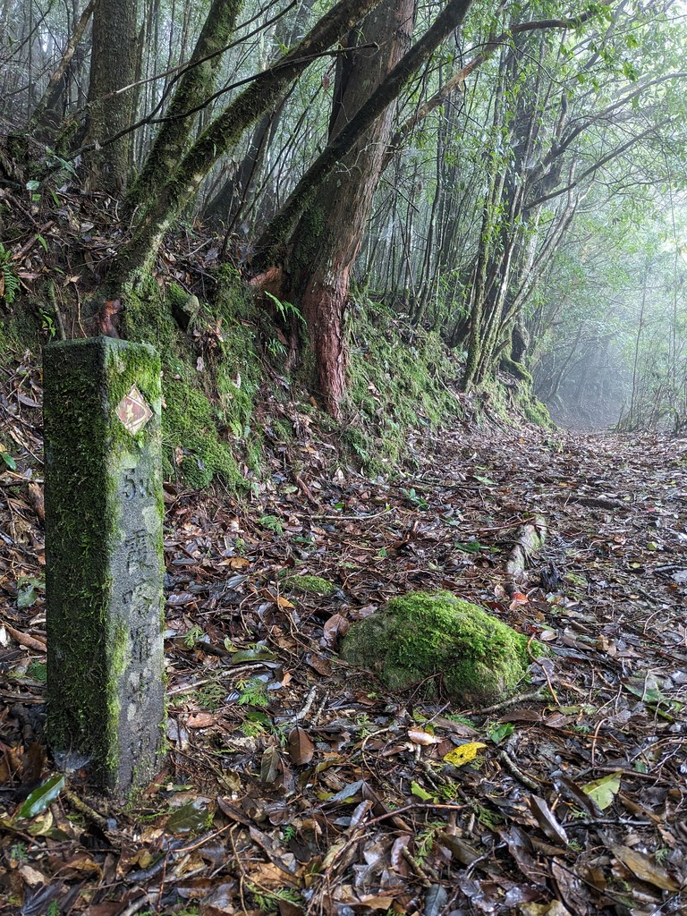
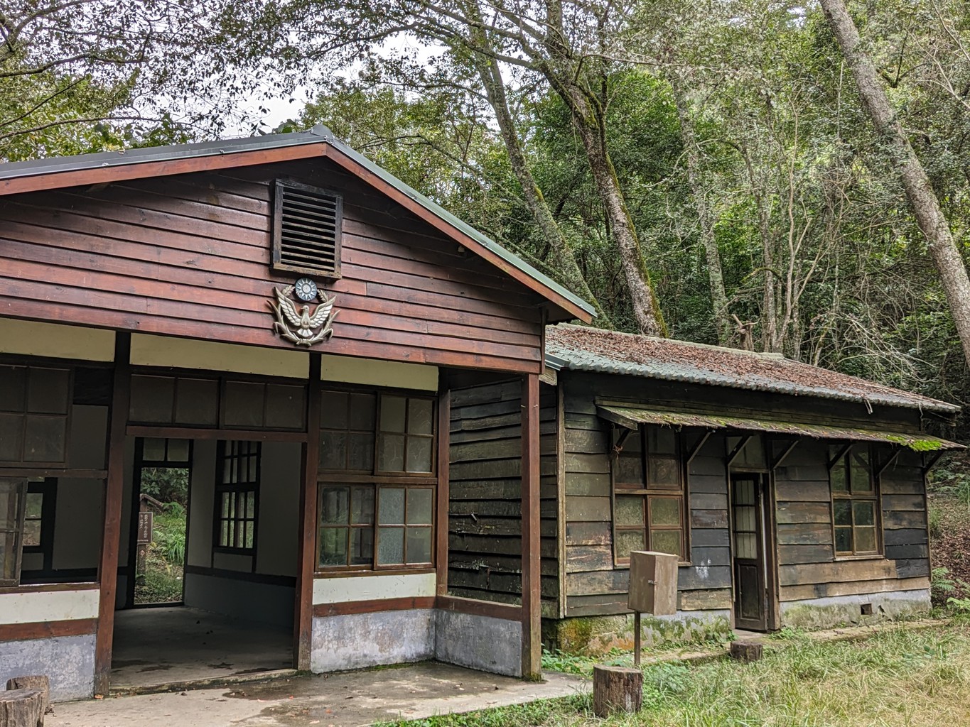
There are stone markers every 500 meters and a few signboards providing context about the culture of the indigenous tribes and the history and logistics of the trail. Apart from that, the forest looks pristine and untouched. Only scant ruins remain from the Japanese police outposts, except for the main buildings at Baishi station, which have been kept intact after the last guard post had been abandoned in 1989. It has been used as a warehouse by the indigenous tribes for a while and, conveniently located around the halfway mark of today’s trail, has become a popular camping spot for those who choose to split the hike into two days.
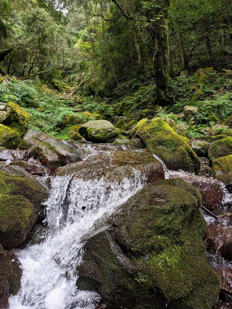
We rest at a small creek around the 9-kilometre mark, sitting on moss-covered rocks and enjoying lunch. The gentle trickle of the water is the only sound we hear. Cell phone coverage breaks from here until the end of the trail many hours later. I can’t think of a better place to escape and leave the challenges of everyday life and the rush of the city far behind. I recall listening to Mick Jagger sing earlier in the day:
I got to take a break from it all
Cause the wind and the wilderness calls
And I just need some peace from the stars
I got to take a break from it all
And I got to take a break for a while
Where there ain’t another human for a hundred miles
Amid the forest, walking by myself for a bit, these lines resonate.
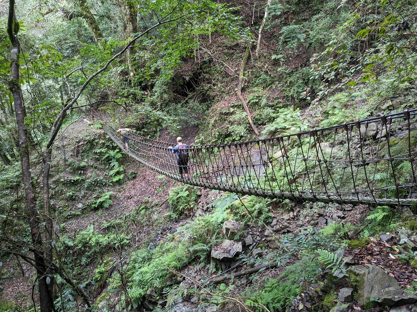
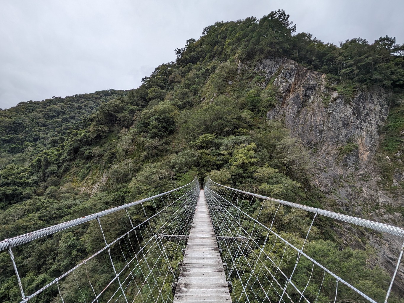
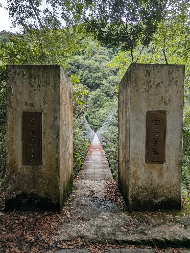
Around the 13-kilometre point, we cross the impressive Baishih suspension bridge. Initially built in 1921, it precariously spans over the Sakayachin River gorge. On our way, we’ve encountered some smaller bridges destroyed by landslides or typhoons. Their remains are slowly rotting away in the riverbed. I trust the stability of this one, crossing it carefully at a steady pace. The ropes are too far apart to hold on to; I rely solely on my legs to stay on the 90-centimetre-wide floor. I still can’t resist stopping in the middle to take a look down. Luckily, there’s no wind and no one else on the bridge to cause it to sway much. Relieved, my feet touch solid ground on the other side, 145 meters later.
After a steep downhill section, the last 7.5 kilometres are easy, mostly flat, passing by a designated maple tree viewing spot. I choose to run large portions of it, training my trail running technique and challenging my legs that have already carried me more than 20 kilometres. Most importantly, it shortens the time until I can finally rest my tired body.
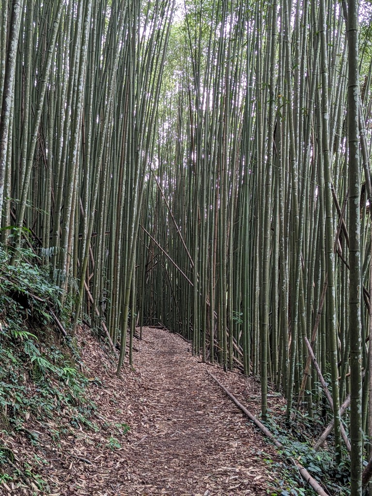
Towards the end of the trail, I pass through a bamboo forest. Later, a sign entitled “A beautiful life” mentions a message passed down through the generations by the Atayal:
We are the fine descendants of our ancestors who told us not to hide behind the wooden planks, but to stand up against our adversaries. We are like bamboo shoots that keep on springing up. As aborigines, we must observe our Gaga (rules, habits and taboos), live a good life on this land and do not disgrace our ancestors. Let bygones be bygones and work together for our beautiful life together.
Our driver already awaits us at the end of the hike. Yoro Trailhead is even more remote, and it has taken him more than three hours to get from one end of the trail to the other.
The point-to-point traverse of Syakaro is an excellent example of a trek where hiring a driver is the most viable option. If you want to manage without, you’ll have to split the group in half, start at opposite sides of the trail and exchange car keys in the middle.
After 1.5 hours of driving, we reach the closest convenience store. Even the Family Mart features the iconic triangular white, black and red ornament representing Taiwanese indigenous culture. Our driver stops to stock up on beetle nuts, and another hour and some fast driving later, we arrive back at Taipei Main, marking the end of another memorable hiking experience.
In my head, I’m already planning another visit, with friends and a few tents, to do the hike over two days. Or alone for a 22k trail running practice.