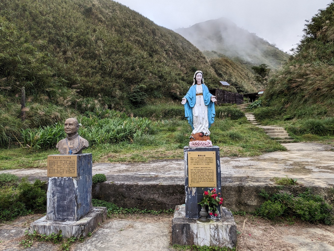
Brother Luigi Pavan (some sources mention his Chinese name as Ba Rueisi) was a Catholic missionary from Italy who loved the mountains. He worked in St. Mary’s Hospital in Luodong for 26 years, primarily treating tuberculosis patients. In 1979, he built a refuge hut at 880 metres near the summit of 三角崙山 Sanjiaolunshan, a mountain between Pinglin, New Taipei City and Jiaoxi, Yilan. With the help of others, Brother Pavan also constructed a trail leading up to it from the Jiaoxi side.
On November 9, 1980, a group of hikers climbed the mountain from Pinglin. Starting late in the day, they only arrived on top in the late afternoon. A decision was made to seek shelter in the hut and descend the following morning. Some group members, however, having to work the next day, insisted on continuing their descent to Jiaoxi. Ultimately, the group split, and four members descended with their guide in the approaching darkness. They carried four candles and a few matchsticks as their only light source.
After some struggle, the group made it off the trail and onto the forest road safely. On their way down they encountered a strange appearance, a shadow of sorts on the roadside between the trees. Coming back the following day to convince themselves that there was no different explanation for what they’d seen, they believed it was an apparition of the Virgin Mary who had ensured their safe descent from the mountain under unfavourable conditions.
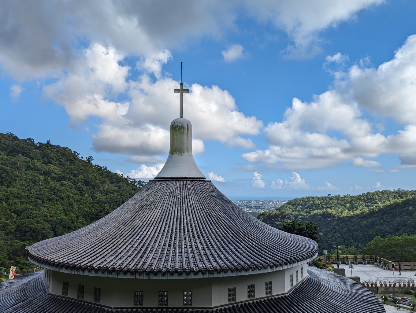
One of the members suggested building a church at the place of the apparitions. After lots of bureaucratic challenges, construction began in 1988, and the Catholic Sanctuary of Our Lady of Wufengqi was finally completed in 2005. The experience of the hiking group and the apparition of the Virgin Mary in Jiaoxi also made headlines all over Taiwan. It lead to a constant stream of pilgrims and other visitors flocking to the mountain.
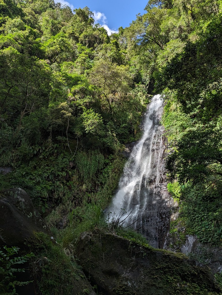
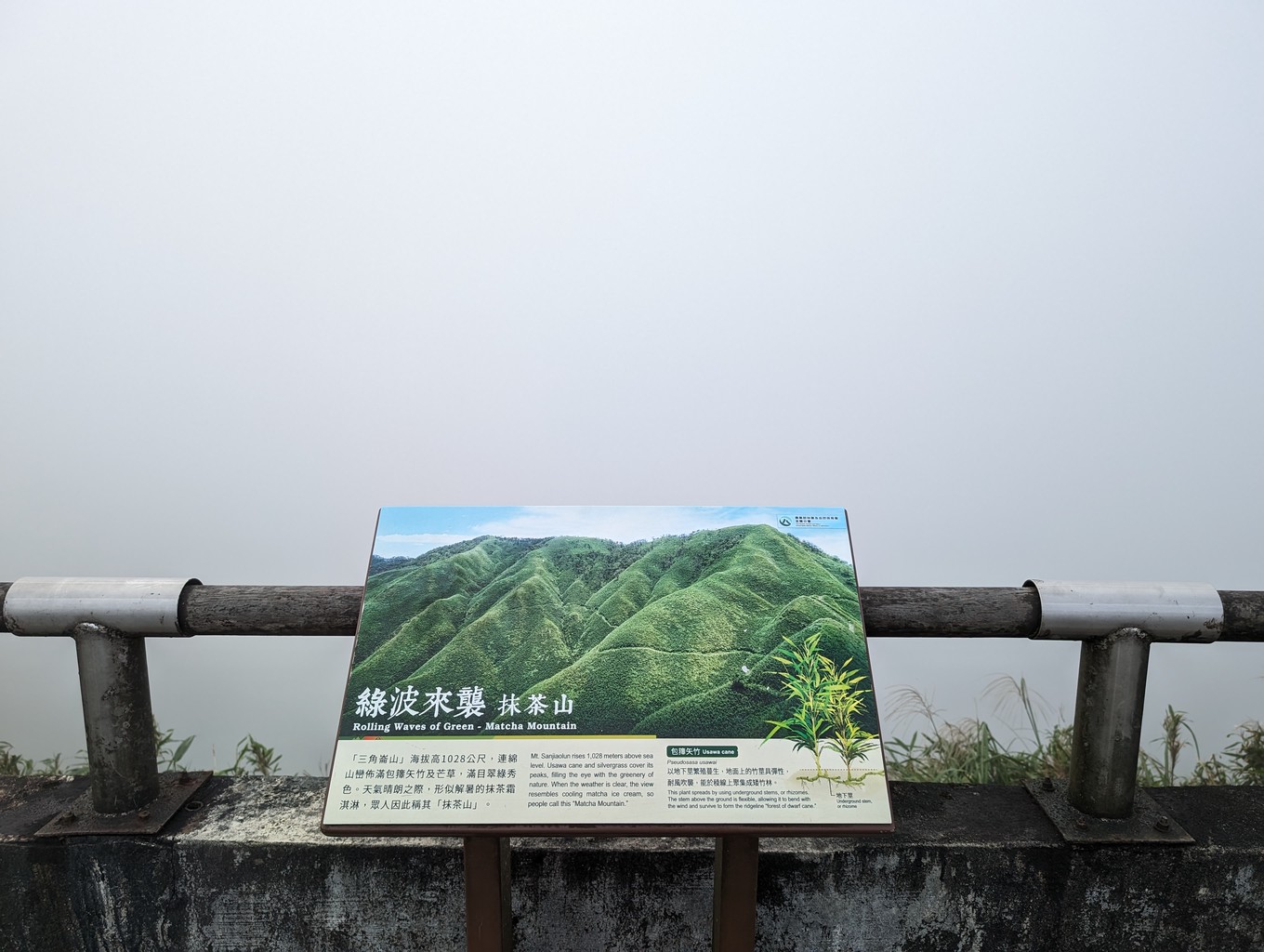
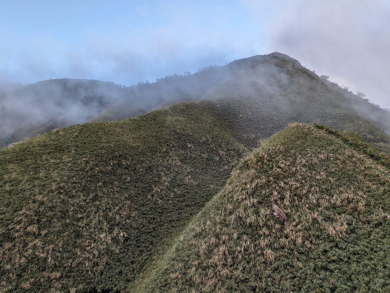
The hike from Jiaoxi is also famous for the impressive three-layered Wuffengqi Waterfalls it passes by. More recently, Sanjiaolunshan was further popularized by Japanese photographer Kengo Kobayashi, who posted images of its rolling green hills on social media. He nicknamed it “Matcha Mountain”, a description that stuck and turned the area into an even bigger tourist hotspot.
Today, Brother Pavan’s original path is known as BaTang Trail. It runs parallel to the more leisurely St. Marian Trail, which is by far the most popular route to the top.
Originally, I intend to climb the mountain from the Pinglin side and descend to Wufengqi. Starting my hike late at 2 p.m., I decide to keep it safe and do an in-and-out hike from Wufengqi instead. I also suspect the trail on the Taipei side to be less developed and more difficult (an assumption to be verified on a future adventure), and lastly transportation to that trailhead is not straightforward.
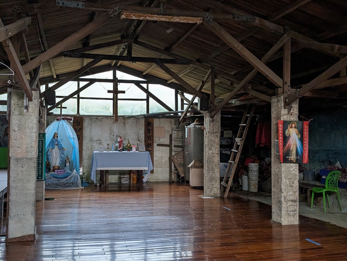
From the parking lot, I begin the hike on a paved path. I take a quick detour to the bottom layer of the Wufengqi Waterfalls, beautifully sparkling in the afternoon sun. A few minutes later, I reach Our Lady of Wufengqi, the famous dome-shaped church overlooking Yilan, the Lanyang plain and the Pacific coast below.
The climb is gradual as the road winds upwards and soon morphs into a comfortable dirt road, disappearing into a calming forest. I gain the first 500 meters of elevation over its 4-kilometer length without too much effort.
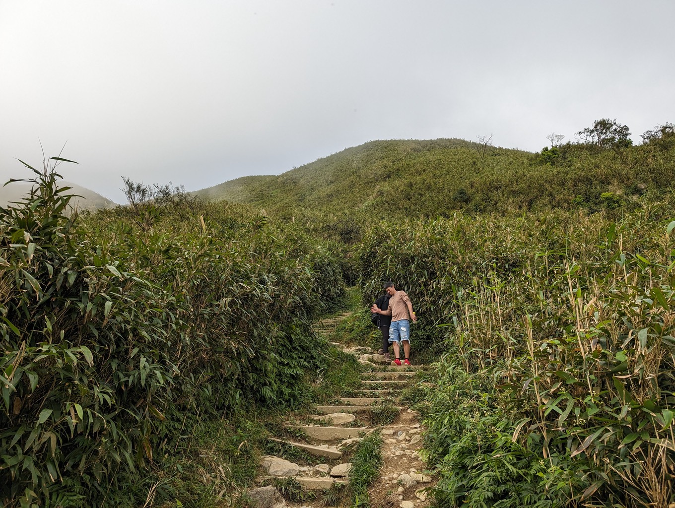
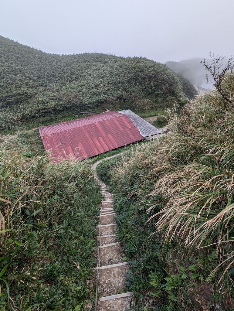
At the end of the road, a small bridge crosses over a creek to the start of St. Marian’s Trail, the 1.6-kilometre hike to Brother Pavan’s refuge hut. The trail follows a small creek at first, then steep stairs quickly cover the altitude difference. There’s a drinking well around the 1km mark, and at 1.2km, I begin to climb atop the forest cover.
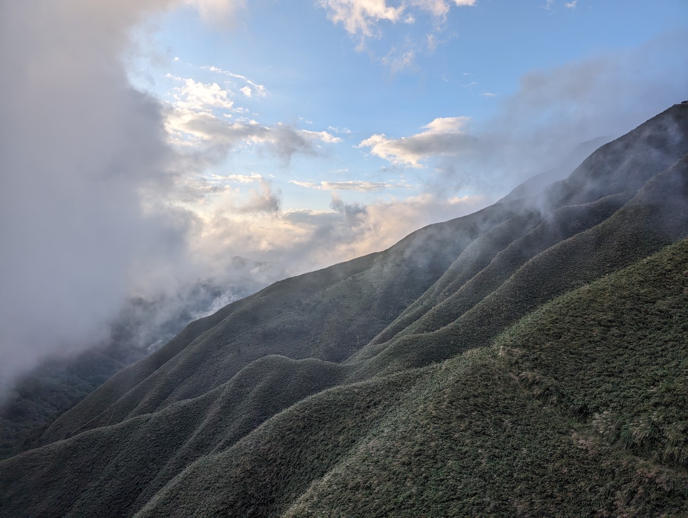
It gets noticeably cooler once I’m out of the forest. The wind blows the afternoon clouds above my head. It’s a common phenomenon that the weather on the windward Yilan side of the mountain is cloudy and wet while it’s still clear in Taipei. The effect is caused by damp air blowing in from the sea which loses most of its moisture when continuing down the leeward Taipei side.
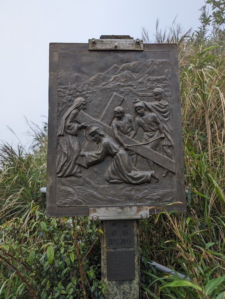
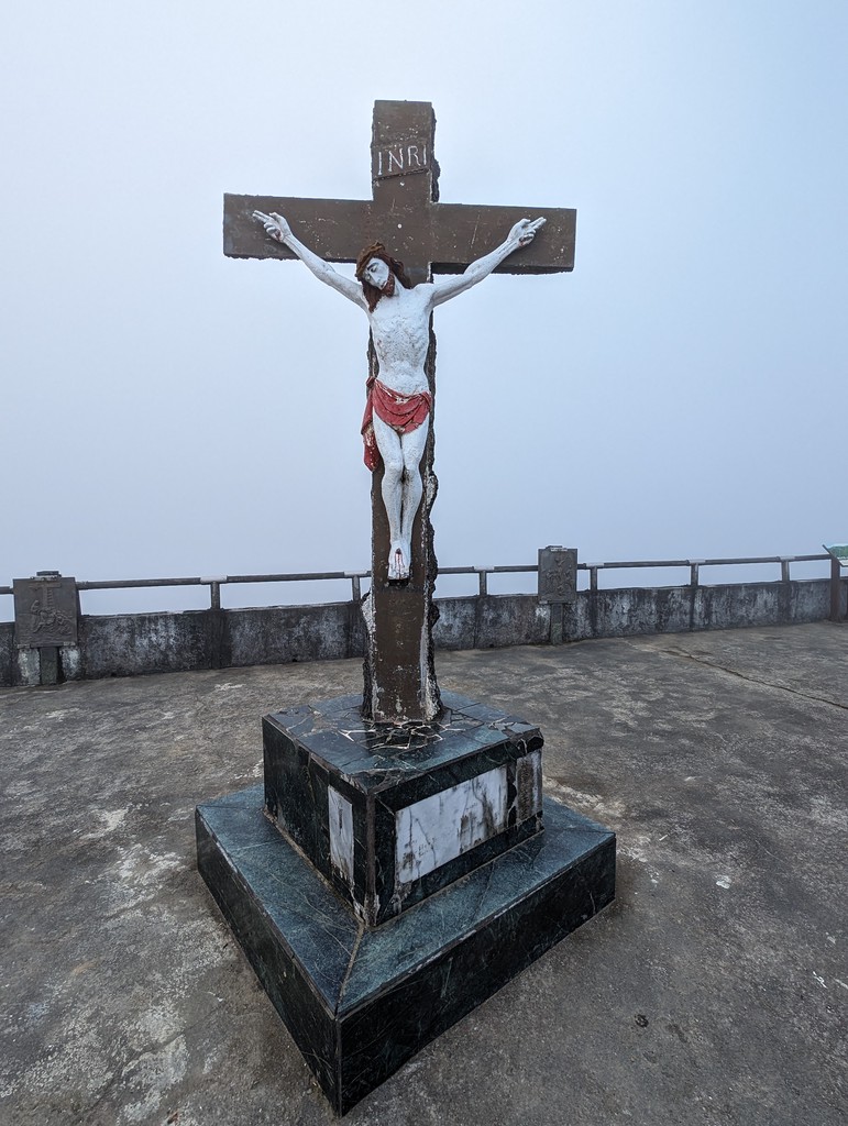
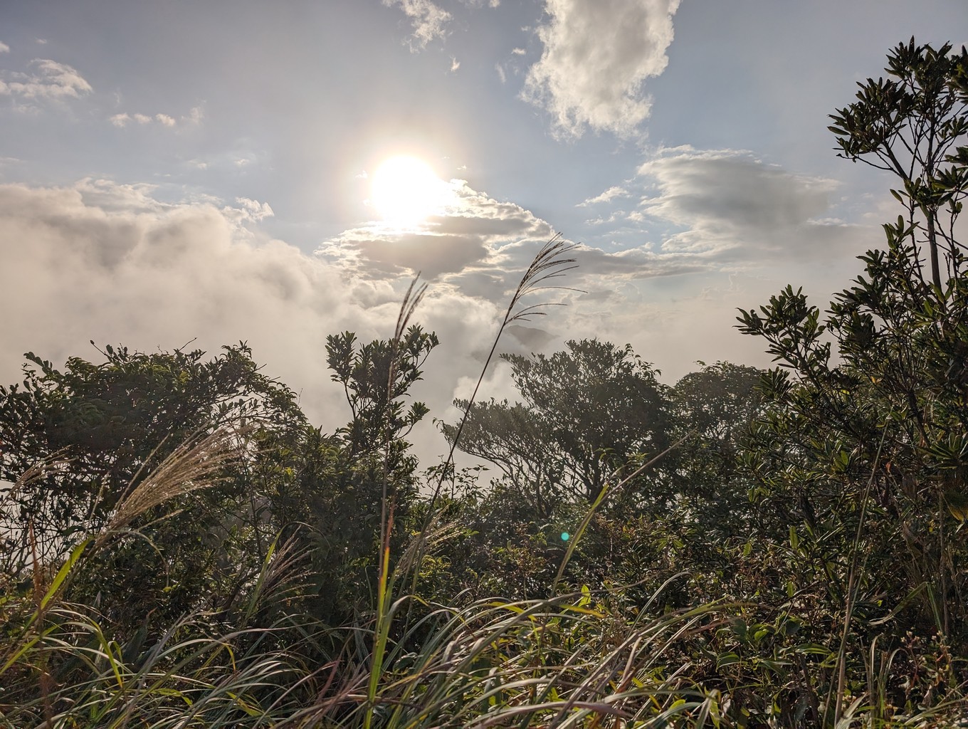
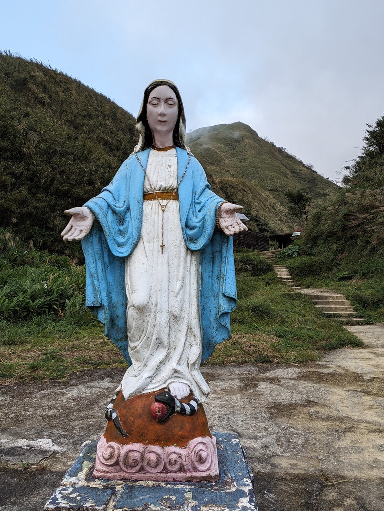
The mountain cabin lies at the end of the trail. A short set of stairs leads up to a viewing platform. Images representing the Way of the Cross decorate the path to the top, and a statue of Jesus is looking down from the mountain. The signboards praise the beautiful green of Matcha Mountain. I can’t help but smile at the irony of seeing nothing but white clouds in all directions.
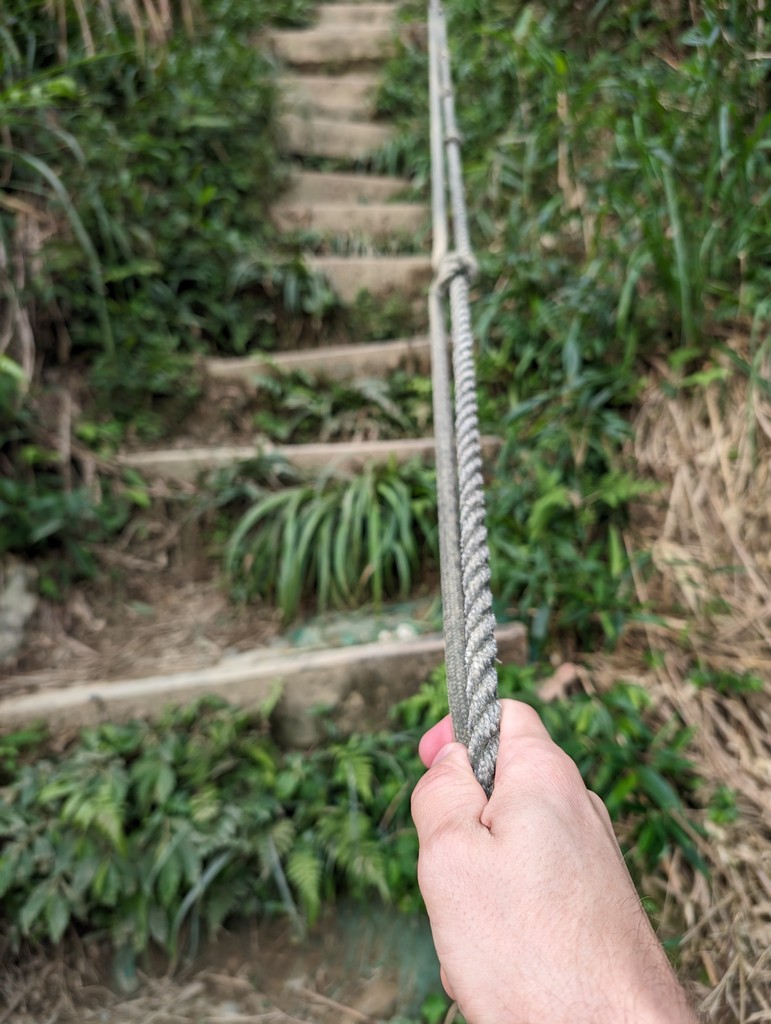
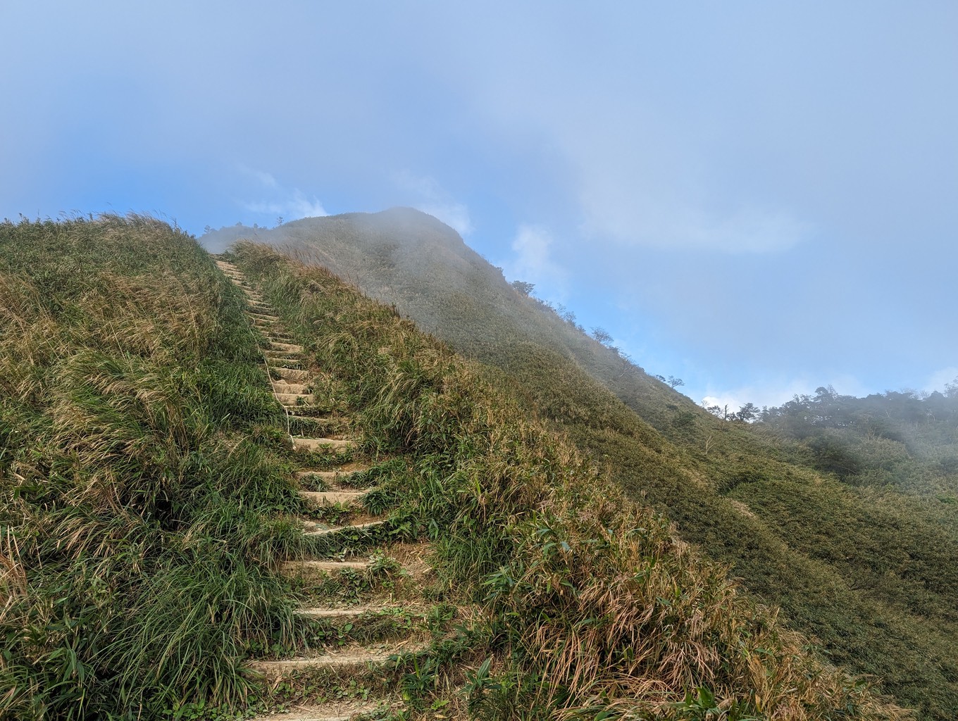
I quickly climb down the stairs, pass the refuge hut and embark on the final stage of my hike. A steeper, more exposed path with some rope sections leads up to the ridge line of Sanjiaolunshan. It’s a relatively short section, and after passing Sanjiaolunshan South East Mountain (1000 m), I finally reach the peak shortly after 4 p.m.
The summit is overgrown, but there are still a few views of the surrounding hills. It helps that I’m tall and can peek over most of the vegetation covering the ridge. Sitting near the triangulation marker eating my snacks, I get lucky, and the sun peaks through the cloud layer a few times.
On my way down, I make another brief detour to another viewing point atop the refuge hut. The clouds have lifted just enough to get a glimpse of what Matcha Mountain could look like on a bright, sunny day. I stay for a few moments before descending. I don’t feel disappointed about the weather at all. It doesn’t rain, and that’s all I’m asking when hiking in Yilan.
I reach the entrance of St. Marian’s Trail as dusk begins to set. I take out my headlamp and jog (most of) the remaining 4 kilometres back to the car. It’s been a wonderful Friday afternoon hike, seeing an impressive waterfall and finding a Catholic pilgrimage at a place where I wouldn’t have expected it. Last but not least, I’ve finally made it to the famous Matcha Mountain I’ve heard so much about from my fellow hikers over the years.