Lidongshan is a 1914-meter-high mountain in Hsinchu County. It’s been on my list of places to visit for a long time, but its remoteness and lack of public transport options made it difficult to get there before.
It’s about an hour’s drive from Neiwan, a village with a beautiful Old Street. Neiwan is an hour from Hsinchu City. If this feels somewhat remote, it’s nothing compared to the adventure of driving to Lidong Lodge from the Eastern side.
The 60 kilometer long stretch from Datong looks inconspicuous on the map, but it’s two hours on windy, remote mountain routes crossing through three counties (Yilan, Taoyuan, and Hsinchu). This is on top of at least three hours of driving to and from Taipingshan and Cueifong Lake earlier in the day.
I didn’t expect a convenience store on the mountain, but I also didn’t anticipate the short stretch between coming down from Taipingshan and driving up the next mountain range not having any options either. I have enough water (and coffee) for the remaining two hours, so I decide not to waste any more time making a longer detour for food.
I take a quick nap at Mingchi National Forest Recreation Area. I’m well rested for the last stretch of the road. It still turns out to be a crucial mistake as I hit a roadblock half an hour later. My heart sinks as I read the big red signboard next to the massive chunks of concrete blocking my way. I translate it on my phone to make sure. It says the road is only open five times daily for fifteen minutes each. The last one is at 5:30pm. It’s 5:50pm. I’ve missed it by a few minutes.
Contemplating sleeping in the car or walking the remaining few kilometres to find food and another place to stay, common sense finally prevails. I follow a group of bikers who escort me back up the mountain. They drive to Yilan, but I stop at a Mingchi Villa and ask for a room. It turns out to be pricey, but I’m just in time for dinner and get a great bed to rest in.
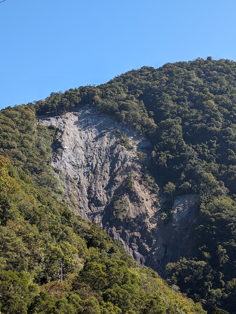
After an excellent breakfast, I make my way down the mountain again. The drive is scenic and beautiful. The trees are showing their autumn colours, and Taiwan’s high mountains peak through the trees in the distance. I pass the roadblock during the 10am opening. The reason for the repairs becomes evident during the day. I can see the damage of a massive landslide, the whole side of the mountain above the road wholly ravaged.
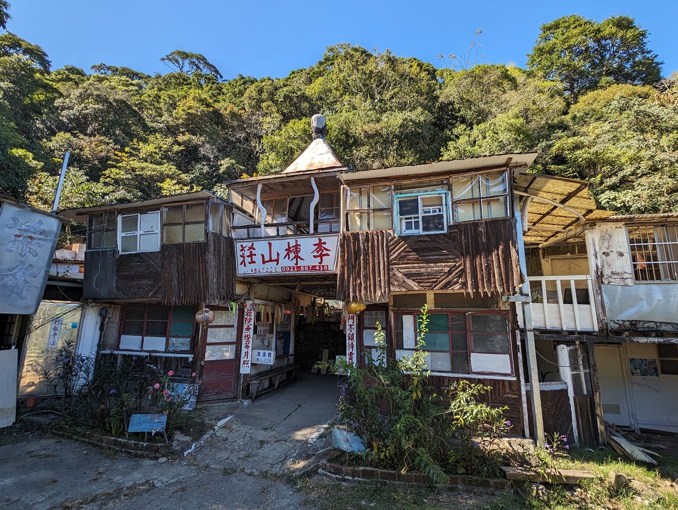
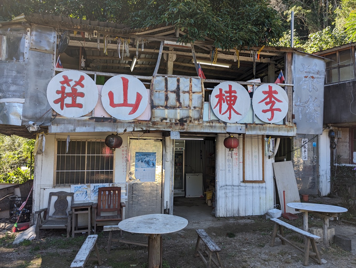
I soon find myself on the final push up another mountain to Lidong Lodge, where I had planned to stay the previous night. It’s a simple B&B in a quirky building right next to the trailhead. I’m relieved I didn’t have to drive this steep, narrow road in the dark. Now, it’s a beautiful, warm day. The sun is out, and my spirits are high.
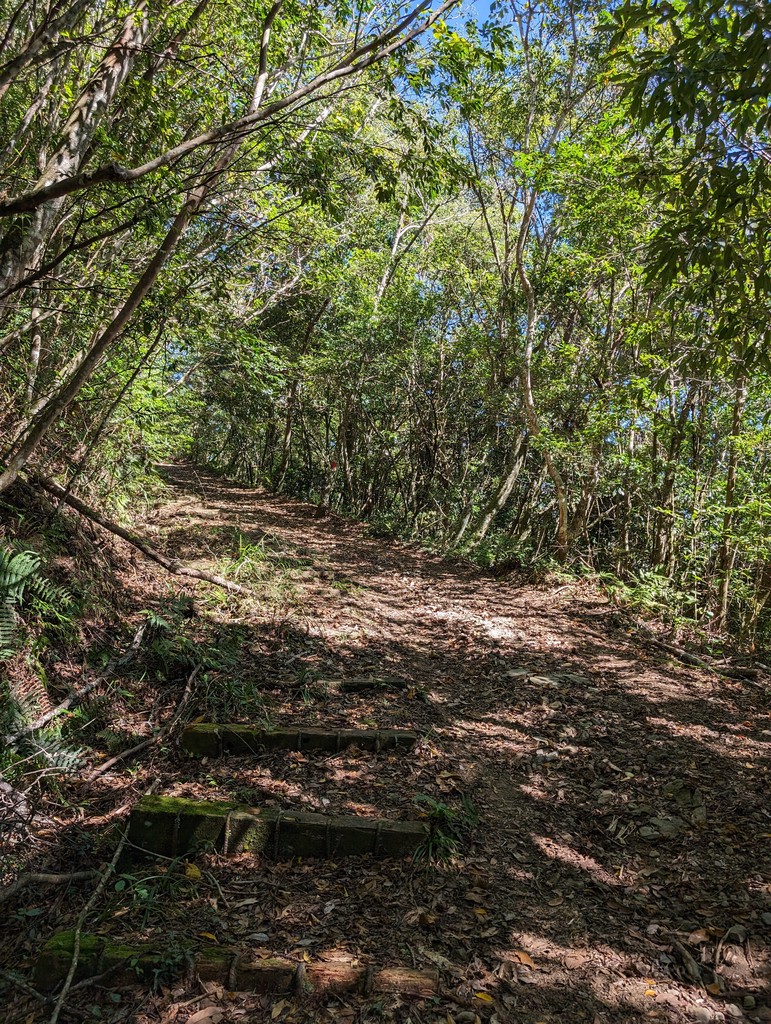
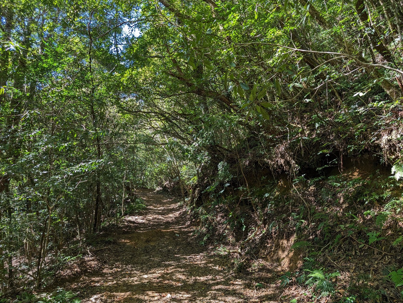
I pass Lidong Lodge and park at the new trailhead 400 meters further down the road. An easy-to-walk dirt road meanders up from here. The original trail starts behind Lidong Lodge and is a more challenging and rewarding scramble through the forest. Both trails intersect multiple times on the way to the top, and I decide to switch to the old one at the first opportunity.
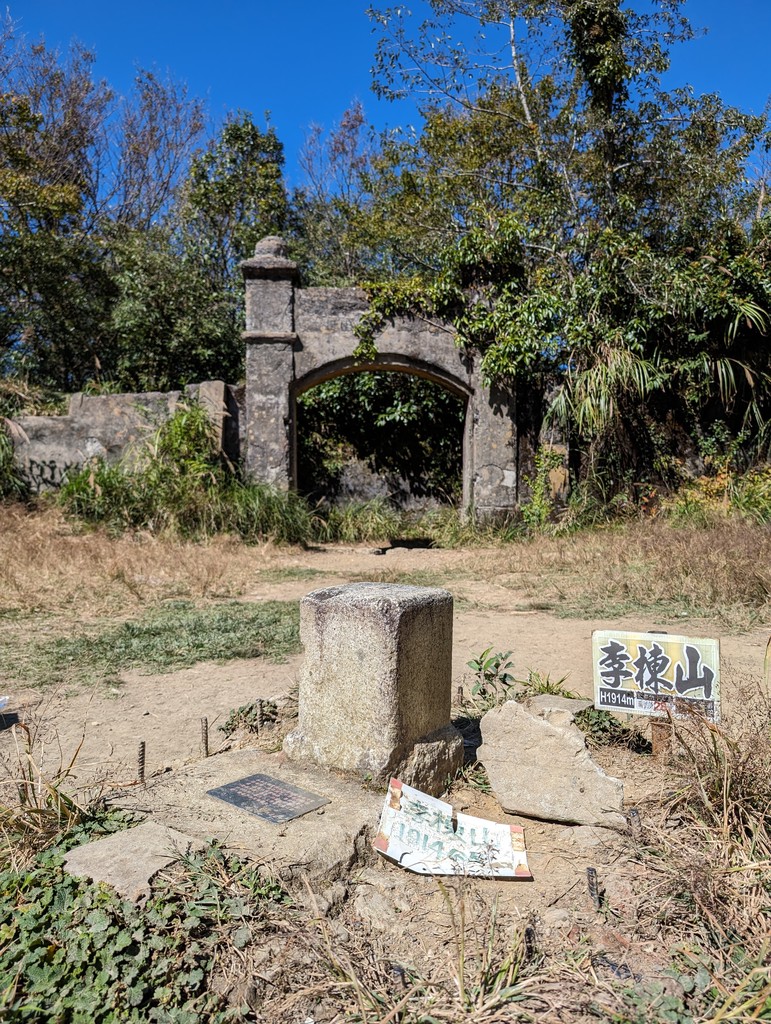
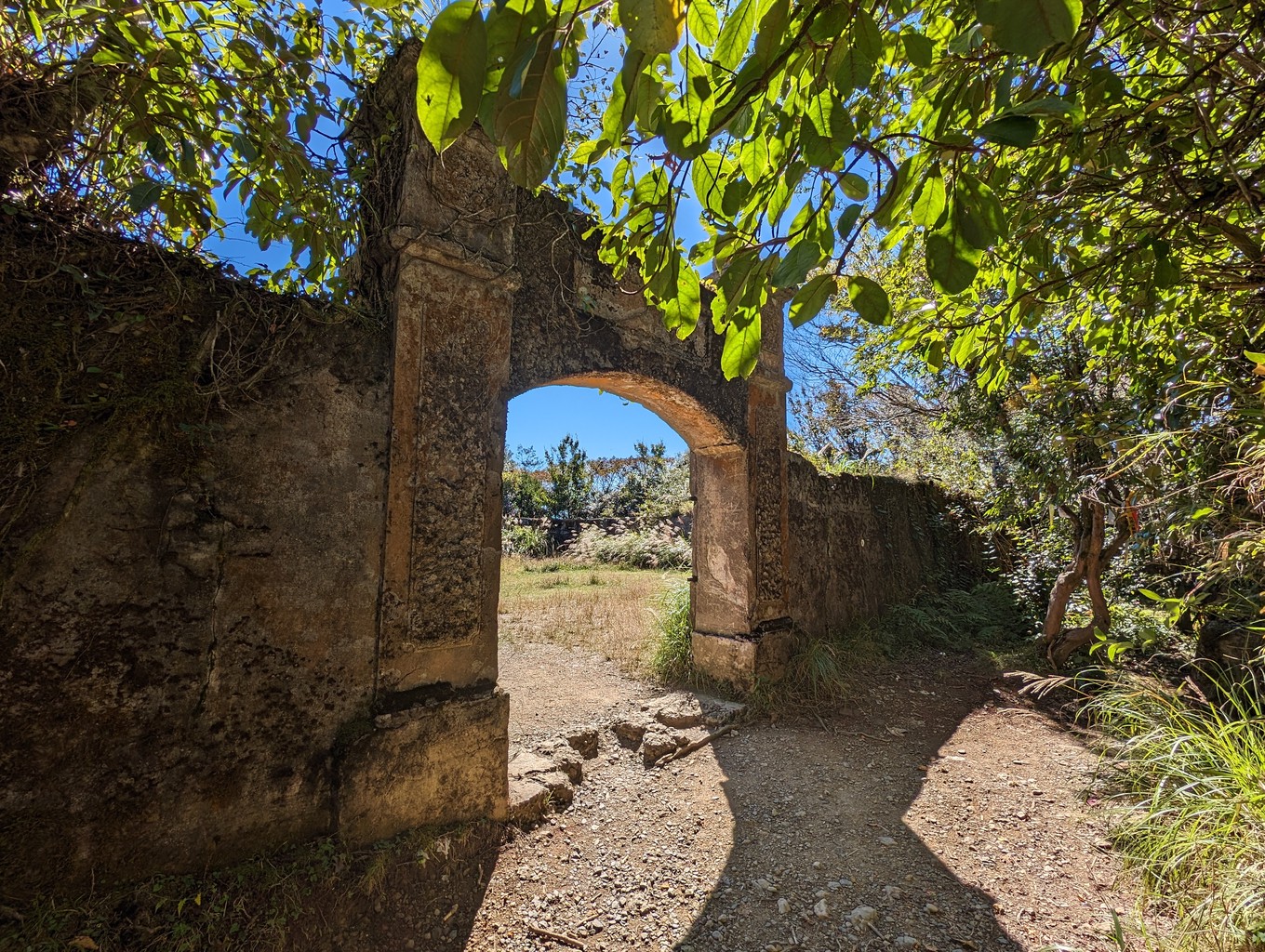
Mt. Lidong is famous for the remains of a fort on top, a witness of Taiwan’s Japanese occupation. Hiking on the island, I often find signs of its history. The Japanese built lots of infrastructure (including the lodging railways in Alishan and Taipingshan, popular tourist attractions today). They also created many trails, some of which are still maintained (or restored) and in use today.
What makes me sad is that the intent of many of these trails was in large part to control, monitor and oppress Taiwan’s indigenous population. While the Han Chinese living on the island were quickly subdued by the Japanese invasion, the island’s Aborigines put up much stiffer resistance, especially in the mountainous areas in central Taiwan.
I first fully realized the scale of this oppression when walking on the Syakaro trail two weeks before. Every few kilometres, I came across a sign highlighting the ruins of another Japanese police station. The density of their outposts impressed and shocked me. In this remote area, subduing the local population was their main purpose.
With mixed emotions, I take my summit photo at the triangulation marker inside the old fort’s walls. A Taiwanese couple sits in the grass a few meters beside me, having a picnic. There are no signboards or explanations, just the quadratic shape of an empty stone fort with its impressive front entrance slowly overtaken by nature.
A while later, I arrive back down at the lodge. The owner greets me eagerly. I buy some persimmons, which are surprisingly soft and sweet and by far the best I’ve ever eaten. While munching on one of them, I walk back to my car, cruising to my final destination: Neiwan.